 ramakaterra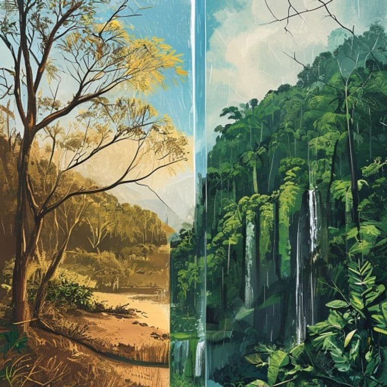
Two Seasons, One Small Town: How "Summer" and "Winter" Run Life in Southern Nicoya
Here's the first thing that trips up anyone moving to Montezuma from a four-season country: the calendar is upside down.
Costa Rica's Pacific coast doesn't do spring, summer, autumn, winter. It does two, and it names them in a way engineered to confuse you. Verano — literally "summer" — is the dry season, roughly December through April, straight through the northern-hemisphere winter. Invierno — "winter" — is the green, wet season, May through November. So winter is when it rains, summer is when it doesn't, and "see you in the summer" could mean July or January. Newcomers spend their first year quietly recalibrating.
The national weather authority, the Instituto Meteorológico Nacional (IMN), describes the Pacific slope as having "una estación seca y otra lluviosa bien definidas" — one dry season, one rainy, well defined — with the rains falling mostly in the afternoon and early evening, mornings often sunny for much of the wet season. Southern Nicoya sits squarely on that Pacific side. And the seasons don't just swap the weather: they change the roads, the water in the tap, the fruit on the ground, the surf, the price of a room, and, quietly, the personality of the whole town.
The quick version
- Verano / dry / "summer": ~Dec–Apr. Bright, dusty, browner, busy, expensive. High season.
- Invierno / green / "winter": ~May–Nov. Green, muddy, quieter, cheaper. Rain mostly in the afternoon; sunny mornings. Low season.
- Heaviest rain lands late — September and October.
- Montezuma-area figures (from climate aggregators, so approximate): ~2,703 mm of rain a year, October wettest (~450 mm), February driest (~16 mm — it "pretty much never rains").
- A "mid-season breather" — a short dry-down inside the wet season — is a real Pacific thing, but documented most strongly north of here, in Guanacaste and the Central Valley. Southern Nicoya feels a version of it.
One honesty note up front: there's no primary IMN station publishing Montezuma-level numbers. The town figures above come from two independent climate aggregators — they agree, which is reassuring, but they're still secondary. The tidier numbers you'll sometimes see (from Nicoya town) are from the drier Guanacaste side, not down here. Same shape, less rain.
Season one: verano, the dry and dusty social one
From roughly December to April, the rain mostly stops. The sky goes reliably blue, the dirt roads reliably dusty, and a lot of the trees do something that surprises people: they drop their leaves. Dry-tropical forest browns out in the dry season the way temperate forest browns out in autumn — just for the opposite reason. The landscape goes tawny, dust on the back roads its texture.
It's also, counterintuitively, the season you start thinking about water — the taps get tight when the sky is clearest. Across rural Pacific Costa Rica, many communities are served by ASADAs (community-run rural aqueduct associations) alongside the national utility, and as surface flows drop late in the dry season, rationing and shortages recur, worst in El Niño years like 2023–24.
One caveat the honest version insists on: the widely-quoted drought figure — surface flows down around 85% — is specifically about the Greater Metropolitan Area of San José, up in the Central Valley, not Montezuma. The defensible statement is the general one: dry-season rationing is a recurring rural-Pacific pattern, with no published Montezuma-specific dataset. So the accurate local shorthand isn't "crisis" — it's the dry season is when locals start watching the tank.
Dry season is also the town at full volume. December through April is high season: crowds arrive, prices climb. If you pictured Montezuma as a sleepy jungle town, verano is when it briefly isn't.
Fruit interlude: the dry season is mango season
For a place dreaming of a farm-to-table kitchen, this is the fun fact: the same heat and dryness that brown out the hills ripen the mangoes. Mango season peaks in the dry season — roughly March through June, heaviest April and May — and across Guanacaste and Nicoya they get so abundant they drop to the ground and get turned into jam. (Caveat: that's documented for Guanacaste/Nicoya broadly, not as a Montezuma harvest record — "the whole peninsula fills with mangoes," not a stat about one town's trees.)
Season two: invierno, the green, muddy, quiet favorite
Then May comes, the rains return, and the whole place exhales into color. This isn't the grey all-day drizzle "wet season" might suggest. The pattern residents describe: sunny mornings, a build through the day, then rain in the afternoon or early evening — you can often plan a whole morning around it. The landscape turns vivid green, the waterfalls run full (Montezuma's own included), and by wide agreement among long-timers, it's the prettier season.
It's also the season you feel in the body — mostly through the roads. The paved artery in (Route 160/21, Paquera to Cóbano, via the Puntarenas–Paquera ferry) is generally passable year-round, but the last stretches down to Montezuma, Mal País and Santa Teresa turn to dirt, with seasonal ruts and a 4×4 advised. In the green season that dirt turns to mud, river crossings swell, and getting around gets, in the sources' word, "complicated," especially in September and October, the wettest stretch.
The Río Lajas — the river that feeds Montezuma's famous waterfall — gets specifically more dangerous in the rains: a mountain storm miles away can send a sudden head of water down a canyon, "much more common in the rainy season when storms are more frequent and the ground is already saturated." Extra caution on the riverbed trail is advised September through November. (Fair warning: the most dramatic flood and landslide anecdotes in these sources come from Jaco and the central-Pacific highways, not Montezuma itself — take those as the general mechanism, and keep the Montezuma-specific part to the dirt roads and the Lajas.)
And then there's the power. Storm-driven outages get more common in the wet season and hit rural spots hardest — a few minutes to, occasionally, most of a day in deep-jungle pockets. Signal is solid in town, weaker on the hilly back roads. These are general rural-tropical patterns, not measured Montezuma uptime numbers — a known feature of rural life here, not official statistics.
Invierno, in bullets:
- Sunny mornings, afternoon rain; everything greens up; waterfalls run full; the town at its prettiest.
- Roads to mud, rivers swell; 4×4 country; the Lajas turns dangerous — extra caution Sept–Nov.
- More power flickers, patchier signal off the main roads. Normal, not catastrophic.
- Low season: fewer crowds, ~20–40% lower rates — and a lot of regulars' favourite.
The water flips too: surf, and one thing we are not
The seasons even swap the ocean. In the dry season, offshore and light winds groom the waves cleaner, smaller, more beginner-friendly (January gets cited as a classic clean-wave month). In the green season, the surf gets bigger and more powerful, because SW groundswells born in the Southern Hemisphere's winter fire up the whole Pacific coast — better for advanced surfers. Santa Teresa, right next door, is the well-documented anchor for all of this.
Now, one thing not to overclaim, because it's the easiest mistake to make about this coast. Costa Rica's Pacific is famous for humpback whales — two runs a year, one of the longest whale seasons on Earth. Real, and also not a southern-Nicoya thing. Whale-watching's capital is the far South Pacific, around Osa and Uvita; the Nicoya Peninsula is explicitly described as not a whale-watching destination. And the Ostional turtle arribadas everyone's seen photos of are on the northern, Guanacaste side of the peninsula, nowhere near Montezuma. Enjoy the whale calendar as the wider Pacific's rhythm, not something off your beach. For genuinely local wild nature, the anchor is right here: Cabo Blanco Absolute Nature Reserve, next door to Montezuma and Cabuya — the oldest protected area in the country.
Two seasons, two towns, two crowds
Here's the throughline, and it's the part that matters most for anyone thinking of living here rather than visiting. The dry season brings a big, bright, transient crowd; the green season brings the opposite — fewer visitors, cheaper rooms, and a smaller, tighter core of people who actually stay. And a striking number of long-term residents will tell you the green season is their favourite: greener, quieter, cheaper, more local, less performative.
Which is worth noticing, because that green-season core is exactly who a community built around rhythm and belonging is for. A place like that doesn't need the town at full volume; it comes alive, arguably, precisely when the tourists thin out, the mornings go quiet, and the rain starts its afternoon routine.
You give up the illusion of a controllable calendar. You get two big tides instead — and you learn, like everyone here does, to plan your whole life around which one it is.
Sources
- IMN (Instituto Meteorológico Nacional) — Regionalización climática de Costa Rica: www.imn.ac.cr/documents/10179/20909/Regionalizaci%C3%B3n+clim%C3%A1tica+de+Costa+Rica
- IMN — Estudio sobre veranillos en Costa Rica: www.imn.ac.cr/documents/10179/20909/Estudio+sobre+veranillos+en+Costa+Rica
- Wikipedia — Clima de Costa Rica: es.wikipedia.org/wiki/Clima_de_Costa_Rica
- Visit Costa Rica — Climate: www.visitcostarica.com/planning-your-trip/climate
- weather-and-climate.com — Montezuma, Puntarenas rainfall by month: weather-and-climate.com/average-monthly-precipitation-Rainfall,montezuma-puntarenas-cr,Costa-Rica
- climate-data.org — Montezuma, Puntarenas: en.climate-data.org/north-america/costa-rica/puntarenas/montezuma-284195/
- WeatherSpark — Nicoya climate (Guanacaste; illustrative only): es.weatherspark.com/y/14905/Clima-promedio-en-Nicoya-Costa-Rica-durante-todo-el-año
- Two Weeks in Costa Rica — Road conditions of specific routes: www.twoweeksincostarica.com/road-conditions-specific-routes-costa-rica/
- Costa Rica Guide — Natural disasters / flash floods: costa-rica-guide.com/travel/health-safety/natural-disasters/
- Costa Rica Guide — Rainy-season driving: costa-rica-guide.com/travel/transportation/car/guide-to-rainy-season-driving-in-costa-rica/
- Pura Vida Traveling — Montezuma Waterfall guide: www.puravidatraveling.com/post/montezuma-waterfall-costa-rica-complete-guide
- CostaRicaTravelLife — Montezuma Waterfalls: costaricatravellife.com/montezuma-waterfalls/
- Tico Times — Costa Rica faces water supply challenges amid drought (San José / GAM specific): ticotimes.net/2024/04/24/costa-rica-faces-water-supply-challenges-amid-severe-drought
- Q Costa Rica — El Niño water rationing: qcostarica.com/el-nino-will-cause-water-rationing-in-the-coming-months-cne-warns/
- Two Weeks in Costa Rica — Living in Costa Rica in rainy season (central Pacific residents): www.twoweeksincostarica.com/living-costa-rica-rainy-season/
- ARA Tours — Electricity & Internet in Costa Rica: www.aratours.com/en/blog/transfer-tips/515-electricity-internet-adapter-in-costa-rica
- Pura Vida Moms — Guide to Costa Rican fruit: puravidamoms.com/costa-rican-fruit/
- Rove.me — Mango season in Costa Rica: rove.me/to/costa-rica/mango-season
- El Sano Banano (Montezuma) — The green season (local color only): elsanobanano.com/the-green-season-in-montezuma-costa-rica-greener-wetter-low-cost/
- Vamos — Costa Rica green season guide: vamosrentacar.com/blog/costa-rica-green-season-guide/
- Vamos — Santa Teresa & Montezuma: vamosrentacar.com/blog/santa-teresa-montezuma/
- Surfline — Santa Teresa surf report: www.surfline.com/surf-report/santa-teresa/5842041f4e65fad6a7708e31
- Surf-Forecast — Playa Santa Teresa: www.surf-forecast.com/breaks/Playa-Santa-Teresa
- The Surf Atlas — Best time to surf Costa Rica: thesurfatlas.com/costa-rica-surf/best-time-to-surf-in-costa-rica/
- Vacations Costa Rica — Whale watching: www.vacationscostarica.com/things-to-do/whale-watching/
- Adventure Life — Best time to visit Costa Rica: www.adventure-life.com/costa-rica/articles/best-time-to-travel-to-costa-rica
A note on how this was made: this piece was researched and written by an AI, working from published climate data, meteorological sources, and secondhand local reporting. Nobody here has waded a flooded Río Lajas in October, watched the mango trees drop fruit in April, or felt the dust on the dry-season roads. Where the data is national or specific to northern Nicoya (Guanacaste) rather than to Montezuma, we've said so — because southern Nicoya, down in Puntarenas province, has fewer primary weather records than you'd think, and honest gaps beat confident guesses. Check the sources above; they're all real.